
The Seven Hanging Valleys Trail is one of the most spectacular hikes in Portugal – if not the world! On this trail you’ll find incredible cliffs, sweeping views of perfect blue-green waters, and secret golden sandy beaches, the best of the Algarve. I’ve hiked all over Portugal and this is one of my favourites anywhere in the country.
Seven Hanging Valleys – The Most Popular Hike in Portugal?
The downside to that, is that this is also one of the most popular trails in the country, in an already popular part of Portugal – The central Algarve. However, if you have the right local information, you can beat the crowds and the summer heat and still get a perfect experience. Keep reading to get all the practical information and local tips you need!
Seven Hanging Valleys Trail Map and Facts
The official title of the trail is Percurso dos Sete Vales Suspensos and its trail code is PR1 LGA.
Length: 7 miles / 11.4 km (out and back)
Elevation Gain: 1,200 ft. / 365 meters
Time to complete: 4-6 hours
Trail Type: Out and Back (we have several ideas on alternate routes below)
Difficulty: Easy / Moderate
Best Time to Visit: Year-round, but avoid extreme weather
Dog Friendly: Yes (Just be careful on the beaches during the summer season).
Seven Hanging Valleys Trail Map
Trailhead Location:
Eastern start point – Praia da Marinha
Western Start point – Praia do Vale de Centeanes
The Best Starting Points and Routes
The Seven hanging Valleys is an out-and-back route, a single path along the coast in either direction. It’s simple, but it does mean you have several options in how you approach the entire trail.
Option 1. The full out and back route
The full out and back route takes around 4-6 hours and has a total length of just over 11km (7 miles).
Option 2. A one-way hike
For people short on time, it’s very simple to complete this hike in a one-way direction and arrange transport (ride shares like uber or bolt) back to your starting location. There’s no public transport, but ride shares and local taxis are available to.
If you’re going to complete it in one direction, I typically recommend taking an Uber to the trail head at Praia da Marinha, and walking in a westerly direction towards Carvoeiro. This means you’ll finish your hike in a bigger town with a wider range of food and drink options, and more transport options as well.
Option 3. See the Details You Want to See.
The third and final option, is to simply pick the places/routes you most want to see and to complete them. The trail runs for 11km along the coast and takes in some stunning beauty spots and incredible beaches. A popular option is to simply pick and choose the places you want to hike to.
The most popular is to walk from Praia da Marinha to Benagil Cave and Praia de Benagil (around 4kms). It’s a shorter hike but gets along the coast and towards some of the most popular beauty spots.
A second option is to utilise the parking at Praia do Carvalho and then hike a little way along the coast along the trail – this takes you directly to one of the ‘secret beaches’ along the main route. This also means you don’t have to commit to the entire route to find the beaches.
The Official Starting Points
Effectively you have two official starting points, the Eastern start point – Praia da Marinha and the Western Start point – Praia do Vale de Centeanes.
Praia da Marinha has the much larger car park, however during the warmer months this fills up very early. There is a smaller car park at Praia do Vale de Centeanes Beach, which fills up quickly too. If you’re driving your own vehicle, you need to be at either car park early (before 8am) or be prepared to park much further away.
Which Direction Should You Hike?
If you’re planning an early start, I recommend you hike in an east-west direction, meaning starting at Praia da Marinha. This has the major benefit of walking with the sun behind you as it rises, and on the return leg it should be high enough to not be too much of a concern. Who likes hiking into direct sunlight?
However, this is the most popular direction, which means the car park fills up quickly and if you’re arriving later than mid-morning can be quite chaotic! Which is why I suggest if you can, leaving your car where you’re staying and taking local transport to the trail heads.
Hiking west-east is no major problem either, just be aware you’ll be hiking into the sun, and later in the day, be hiking into the crowds.
How to Get to the Trailheads
This all depends on where you are staying, and how you are planning on getting around. If you have your own vehicle, simply drive, and park at either car park.
If you’re staying nearby (and even if you have your own car) I’d recommend getting an Uber/Bolt or local taxi. The car parks fill up, there are often queues, and people start parking all over the place. If you’re nearby, I’d really recommend skipping the hassle and getting an Uber.
Why is it called the Seven Hanging Valleys?
Well, if you hadn’t guessed it, there are 7 valleys that you’ll hike up and down again. It’s one of the reasons that the hike surprises some people. The overall total elevation gain is not much, but you will repeatedly walk to almost sea level and back to the cliffs again multiple times.
Top Places to See during the Hike
- Praia da Marinha: One of the most famous beaches in the region, with striking limestone sea-stacks, arches, and clear water. It is often rated among Europe’s most beautiful beaches.
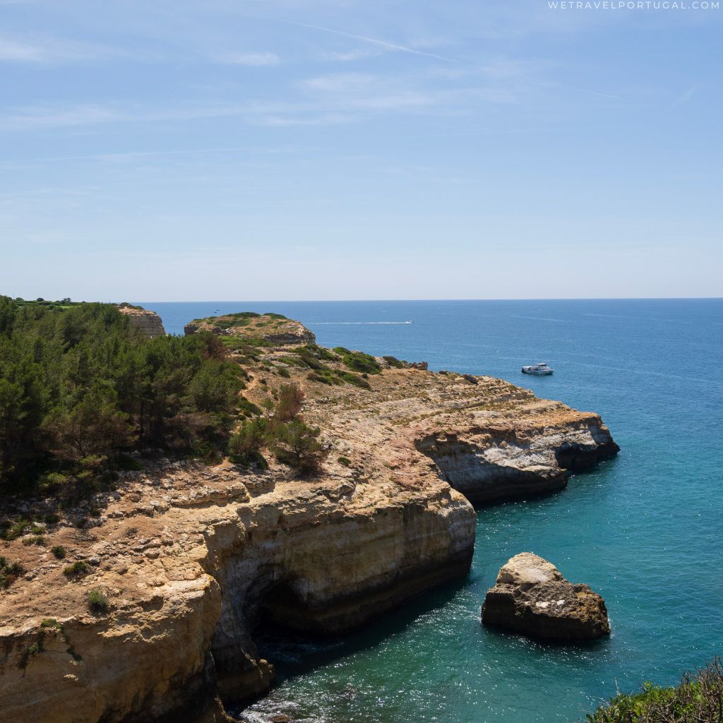
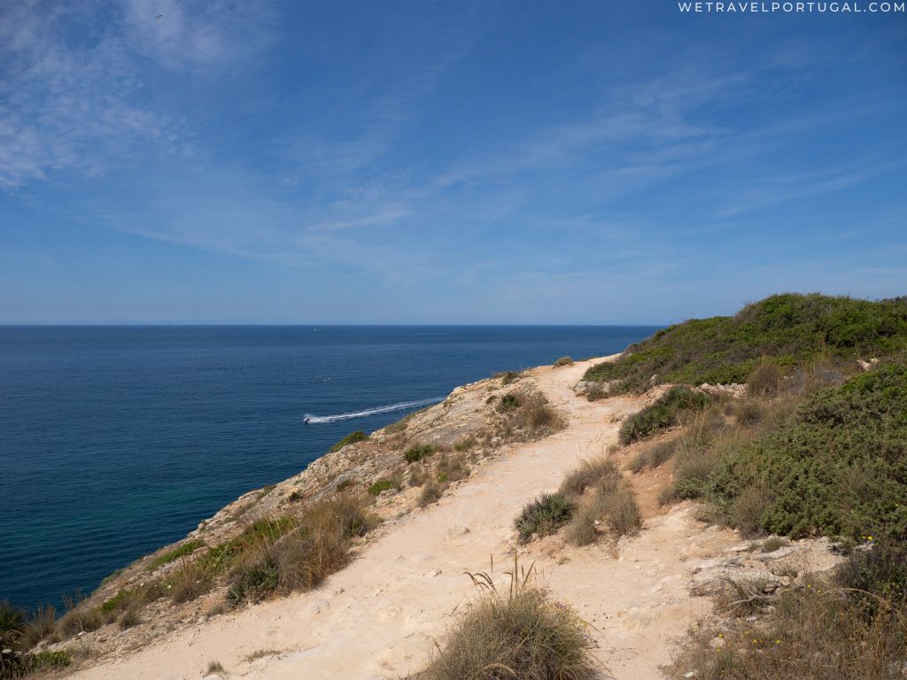
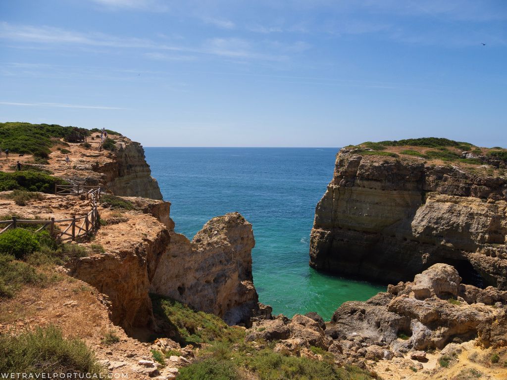
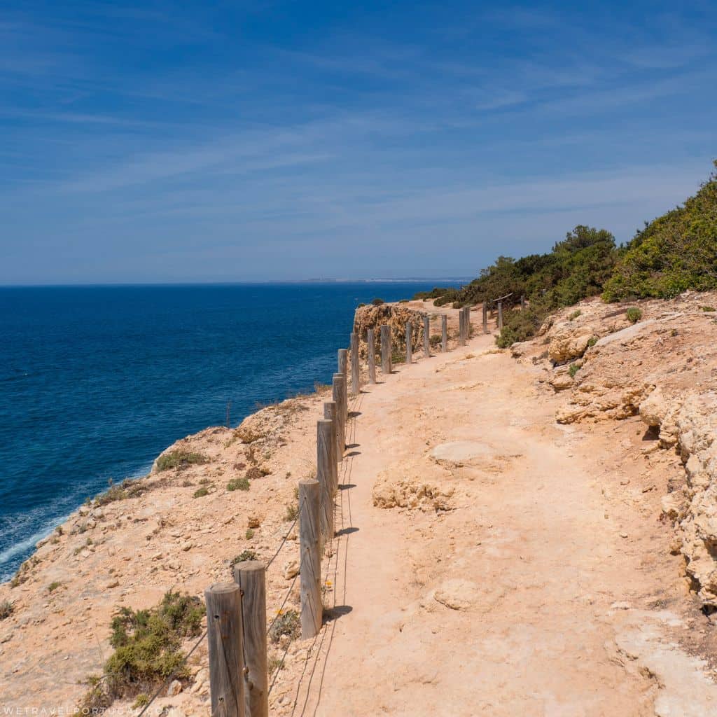
- Coastal cliff-walks with dramatic viewpoints, natural arches, drop-offs and panoramic sea views.
- Benagil Cave & Benagil Beach: A major highlight – from the trail you can see the cave top-opening, although to access inside you’ll need to reach it by boat or kayak.
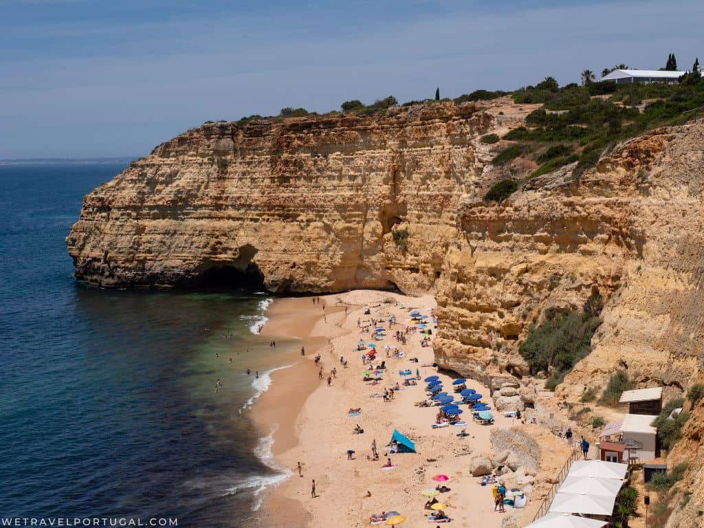
- Praia do Carvalho: A lovely little more-hidden beach with tunnel/stair access and fewer crowds if you detour.
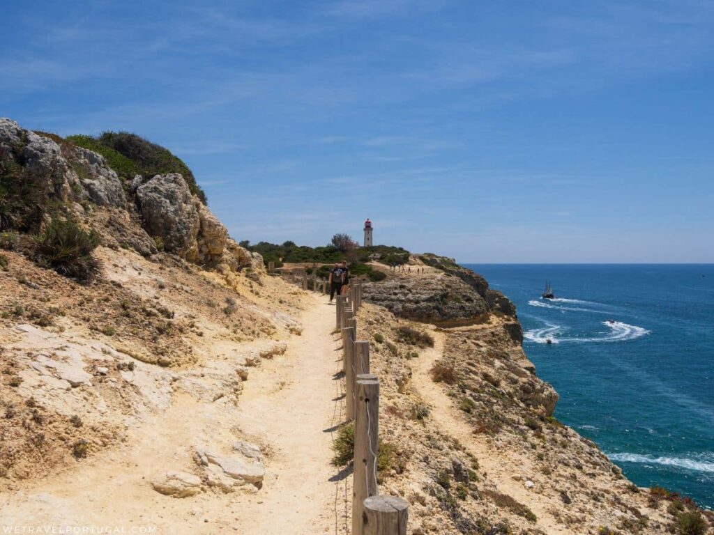
- Farol de Alfanzina (Alfanzina Lighthouse): A viewpoint towards the end of the trail; scenic and memorable.
- Vale de Centeanes – The official end-point beach, Vale de Centeanes, is a nice place to rest, swim and enjoy some local food.
Know Before You Go
- Pack plenty of water, and snacks.
- Wear a hat and suncream
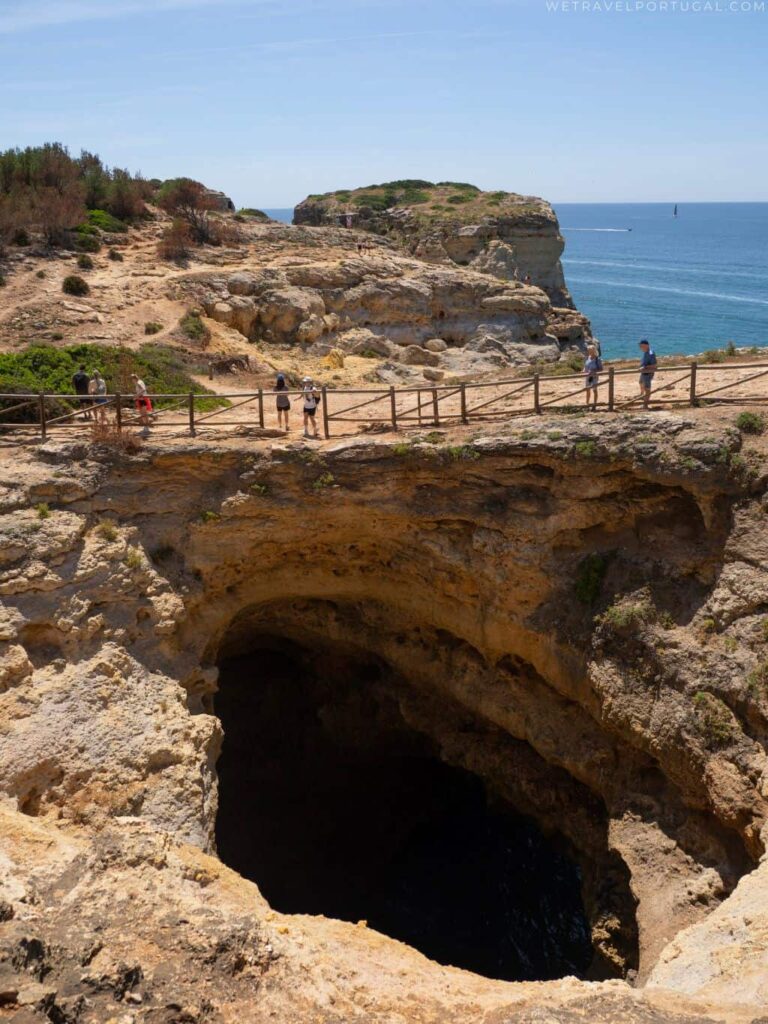
- Be careful on cliffs and around sinkholes and caves
- Take breaks when you need to
What Footwear to Wear on the Trail?
The question I probably get asked most about the Seven Hanging Valleys is what footwear should you wear. Along the trail you’ll see all manner of footwear types, from flip flops and sandals, to full size hiking boots.
The best answer to this question is to wear a secure fitting shoe that you are comfortable in. The paths are mostly graded, and there’s not much more than uneven terrain and sandy gravel at its most severe parts, but I still wouldn’t recommend completing it in flip flops. In wet weather, parts of the trail can get muddy and slippery too!
The Complete Seven Hanging Valleys Guide
With most of the practical information out of the way, now I’ll go through each of the main sections of the hike. These are not official sections, but perhaps the most popular way of breaking up the hike. As it’s my most recommended way of following the trail, I’ll take you through the hike from east-west.
Marinha Beach to Benagil Beach
Total Distance: 1.1 Miles / 1.8 km
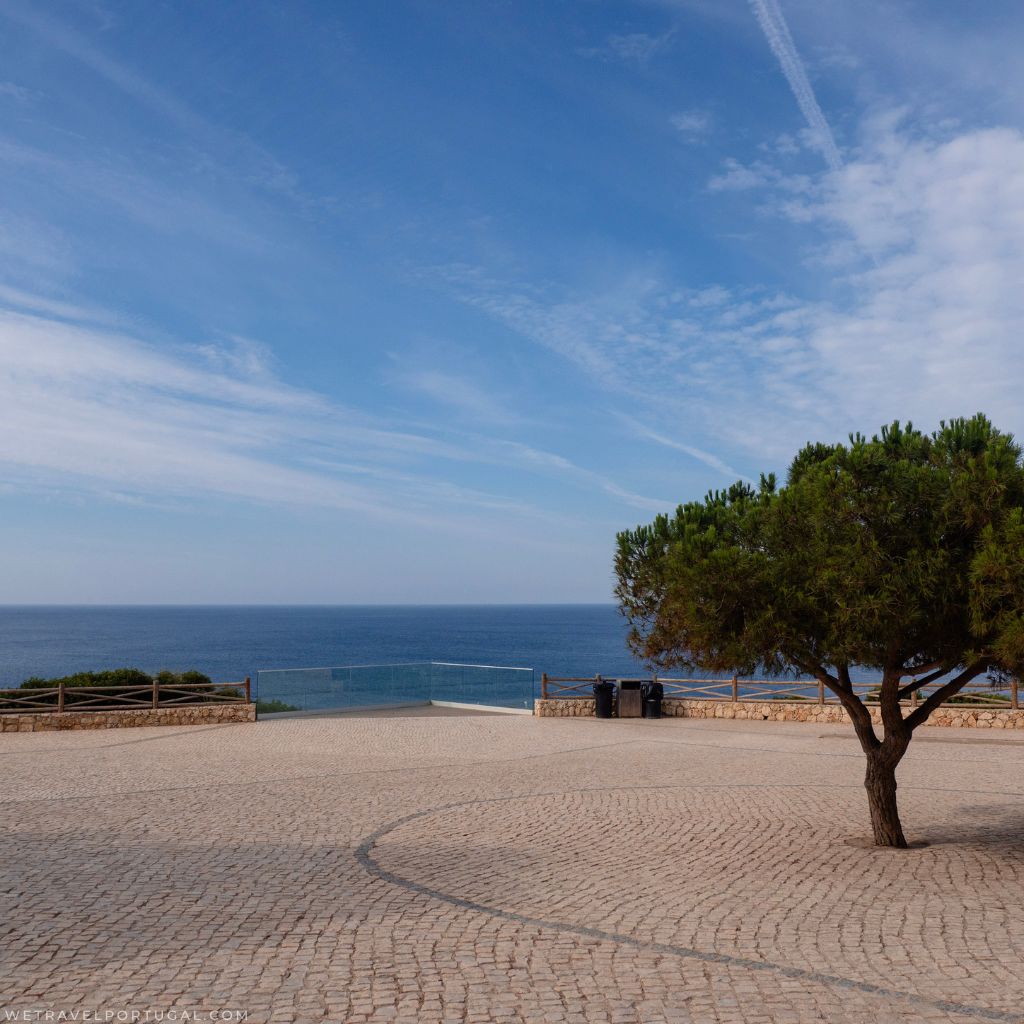
The official starting point of the trail, and car park. If you want to see one of the most stunning beaches in the Algarve (and often voted as such) then a very short detour east instead of west will lead you to Praia da Marinha. It’s a small beach surrounded by golden rock formations – it is not an essential part of the hike, in fact you are going to see a lot more beaches and rock formations, but you can tick the beach off this way.
Officially the hike starts in the car park, and you’ll pass a small glass look-out point which is a popular photo spot. After this, you’ll follow the small walking route signs and head west along the coast.
During this section, the path is quite gravelly, and along the cliff tops you’ll pass many large and sometimes smaller sinkholes. Most are surrounded by fences, but there’s a few more hidden ones around. For this reason you should always stick to the trail.
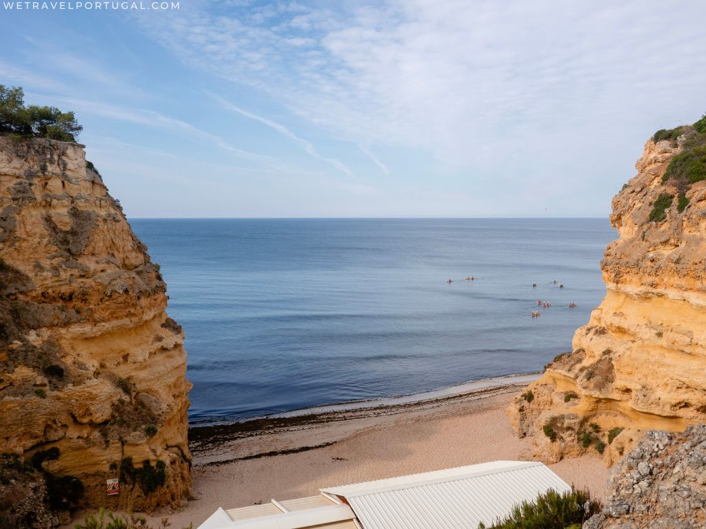
The first beach you’ll come across is Praia do Cão Raivoso, which is only reachable from the water. It’s a popular spot for the kayakers though! The next beach you’ll pass is Praia da Corredoura – again only accessible from the sea!
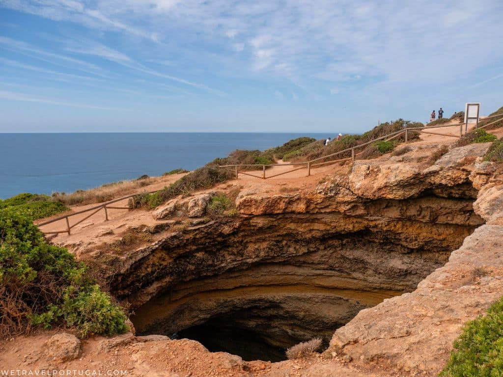
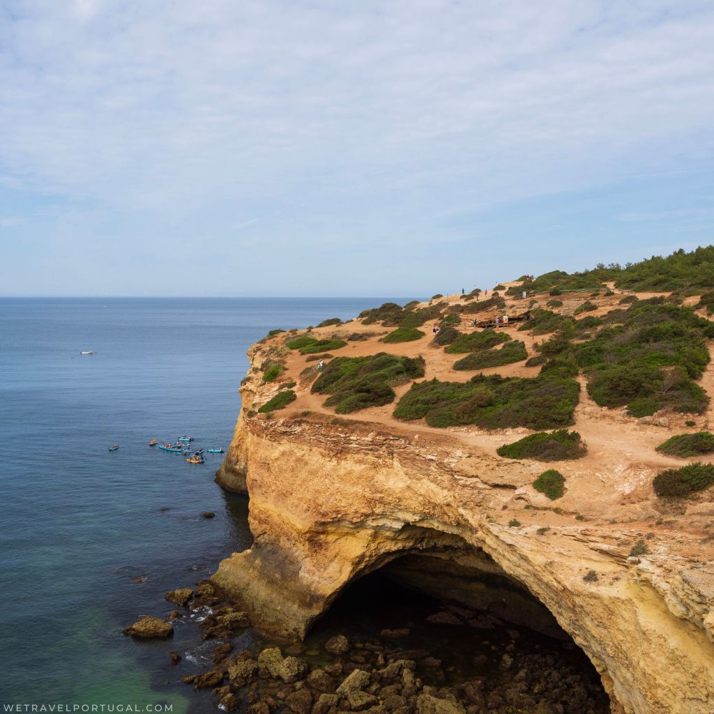
Benagil Cave – Algar de Benagil
In this section is the very popular Benagil Cave. At this point of the hike you’ll approach the large cave from above, it’s here that you’ll get a sense of the size of it – even if you can’t get the full view of it.
It is really important to pay attention to the warning signs, and barriers, the cave is 35m high and the cliffs are unstable. Every year there’s at least one or two cliff rescues in the Algarve from someone trying to get their perfect photo. After viewing the cave, you’ll head back along the cliffs and towards Benagil Beach (Praia de Benagil).
The Busiest Part of the Trail
It is in this area that the trail feels the most chaotic, a combination of walkers completing the trail, and visitors to the beach going to the see the cave from the water.
There’s a large amount of traffic as the boat tourists collide with the kayakers and paddle boarders. Throw in people taking the short walk up to the top of the cliff to see the cave above, and the touts trying to sell you boat trips and kayaking experiences, and it can feel a bit much. Rest assured though, once you pass the beach it gets a lot less crowded and feels like a normal hike again!
If you are interested in visiting the cave from the water, my recommendation is to save that for another visit and not combine it with the hike! However, if you’re short on time, there are plenty of boats available making the short journey into the cave. Additionally, visits inside the cave are timed, so traffic moves swiftly!
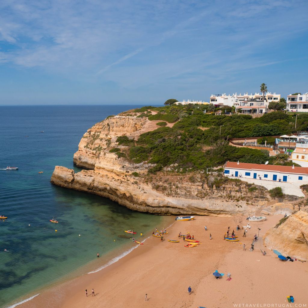
Benagil Beach to Praia do Carvalho
Total Distance: 0.5 Miles / 0.8 km
Benagil beach is small but quite chaotic, in fact I don’t really recommend spending too much time on the beach itself. It’s the main launching point for boats, and kayakers/SUPers. It feels like a bit of a rodeo of parking, queues, safety briefings, and boat arrivals. That said if you want to take a breather you can walk to the eastern side of the beach where it feels much calmer.
If not, then continuing with the trail you’ll head along the eastern cliff edge, you’ll first pass through what feels like a restaurant (it’s spread out along a veranda) but this is part of the sign posted trail. Once you depart, you’re back along the cliff edges on the trail. The next main focal point being Praia do Carvalho.
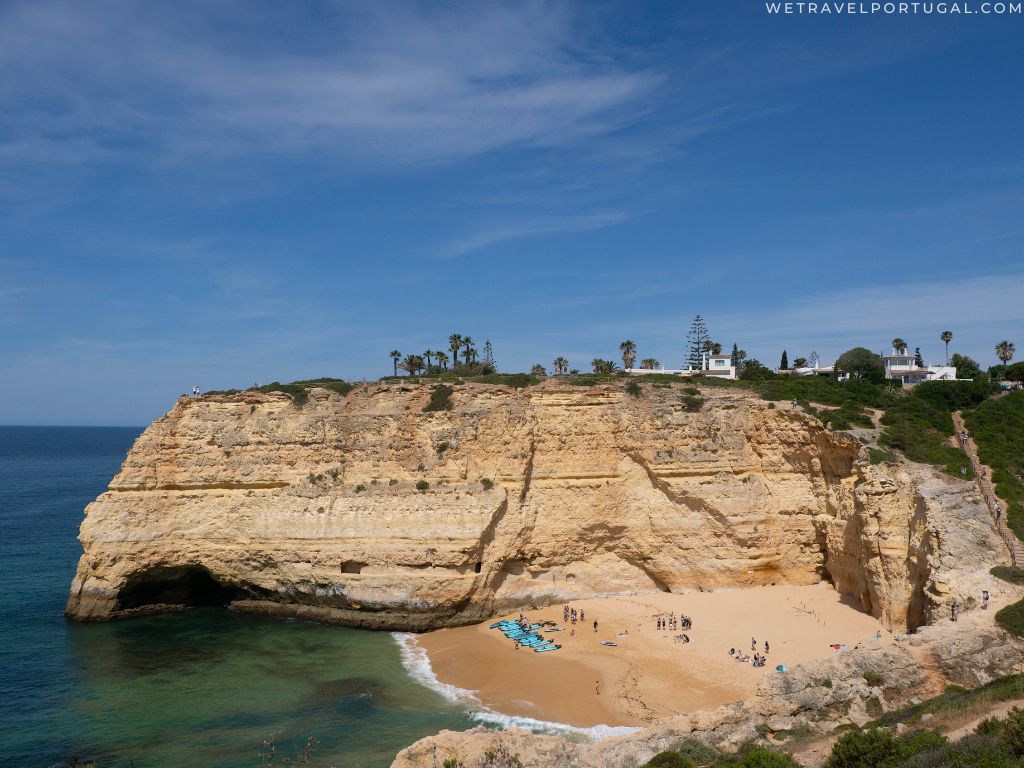
Praia do Carvalho to the Alfanzina Lighthouse (Farol de Alfanzina)
Total Distance: 0.8 Miles / 1.3 km
Praia do Carvalho is another of the brilliant beaches in the region and a great resting point. You can even cool off with a swim if you’re prepared. It’s a unique beach that’s well known for its ‘tunnel access’, you’ll head down a set of stairs and loop under a path to get access to the beach.
Praia do Carvalho is a small beach surrounded by cliffs, so it’s fairly sheltered on any windy days. It also offers good shade during the morning and evenings!
From Praia do Carvalho it’s around half a mile to the next major focal point – Farol de Alfanzina.
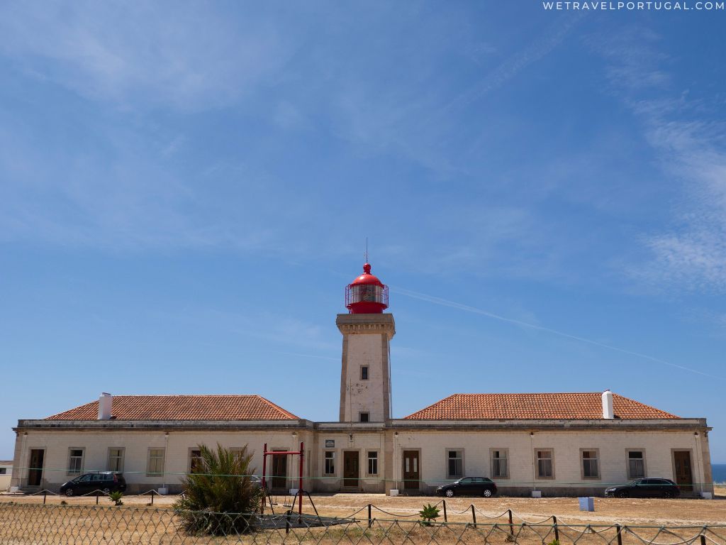
Alfanzina Lighthouse to Praia do Vale de Centeanes
Total Distance: 1.1 Miles / 1.8 km
This stretch has the most scenic lighthouse viewpoint – it’s also surprisingly easy to get lost as the trail spreads out along many dusty tracks and low scrub. There’s another spectacular blowhole in the cliff too. The trail here then follows tightly along the cliff edge until you reach Praia do Vale de Centeanes, the official ending point. There’s a very nice beach, and a small beach or you can head further into the small town to rest in a any of the nearby cafés. Congratulations, because you’ve completed the full length of the hike – depending how you feel you’ll be turning back or carrying on!
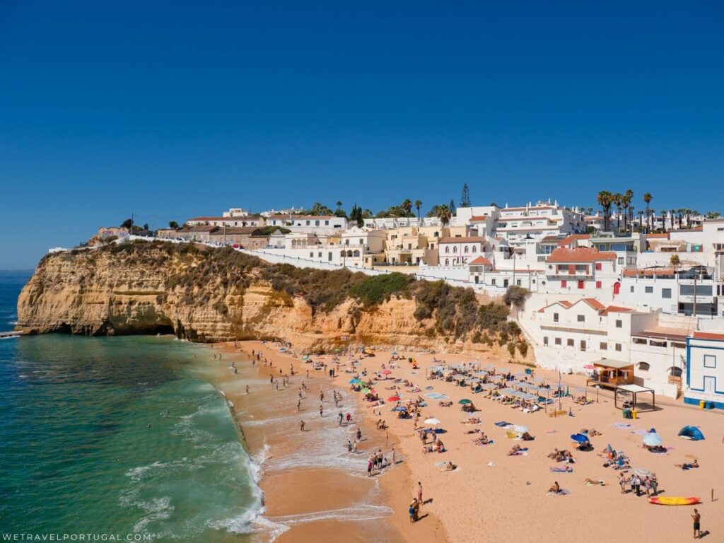
Praia do Vale de Centeanes to Carvoeiro (optional)
Total Distance: 1 Miles / 1.7 km
This final mile is totally optional, and not part of the official trail. However, if you’re looking for food, refreshment or a good place to rest it is well worth this final effort. The ending point is in Carvoeiro, a small resort town that has a wide range of cafés, bars, and restaurants available. Additionally, it’s got a great beach for you to rest on, or even cool off with a swim.
Where to Stay to Complete the Seven Hanging Valleys?
If you want to skip much of the transport and parking dilemma, staying on the trail itself or very close by is well worth it. My most recent completion of the hike, I actually stayed in Pestana Palm Gardens – it’s a very short walk from Praia do Vale de Centeanes (the official starting/ending point). From here, I ubered to the trail starting point at Praia da Marinha and it cost me and my friends around €10!
That said, there’s lot of other great places to stay in the area – Carvoeiro has multiple options, and nearby in Armação de Pêra there’s lots more.